


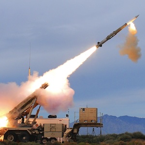


 The Government Circuit: Driving Resiliency and Economic Security on Both Sides of the Atlantic
 American Made Advocacy: Taking the Fight to Capitol Hill
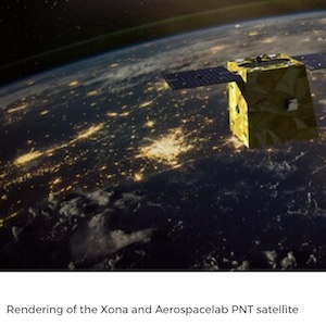
 Defense Speak Interpreted: SWaPing Nanosatellites for Defense Systems
Airbus Expands Its SpaceDataHighway With Second Satellite
July 17, 2020 | AirbusEstimated reading time: 2 minutes
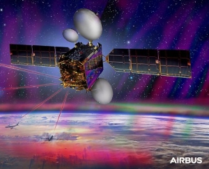
The EDRS-C satellite, the second node of Airbus’ SpaceDataHighway constellation, completed its commissioning tests on 15th July 2020 and is now ready to start operational services. Following its successful launch in August 2019 and manoeuvring to its geostationary orbital slot at 31 degrees east, in-orbit testing has been executed and laser communication links have been established to the Copernicus programme’s Sentinel Earth observation satellites.
EDRS-C doubles transmission capacity and the constellation is now able to relay the data from two observation satellites simultaneously. It further strengthens Airbus’ commitment to serve the existing Copernicus programme as well as future Sentinel missions. The additional capacity will also enable Airbus to accommodate further customer needs. By 2030, about 15 satellites should use the very high bandwidth data connectivity of the SpaceDataHighway.
From 2021 onwards, Pléiades Neo – Airbus’ most advanced optical Earth observation constellation with four identical 30 cm resolution satellites – will be the next satellites to benefit from the SpaceDataHighway’s infrastructure. As an integral part of Pleiades Neo’s full end to end service, SpaceDataHighway will further optimise mission reactivity providing for real time tasking and very high throughput data offload.
EDRS-C has joined the EDRS-A satellite which daily transmits images of Earth acquired by the Copernicus programme’s four Sentinel observation satellites. Since 2017, EDRS-A has achieved more than 35,000 laser connections. These successful connections have downloaded nearly two petabytes of data with an availability of 99.5 percent.
The SpaceDataHighway is the world’s first laser communication geostationary constellation. It represents a game changer in the speed of space communications, using cutting-edge laser technology to deliver secure data transfer services at a rate of 1.8 Gbit/s in near-real time.
Its satellites can connect to low-orbiting observation satellites at a distance of up to 45,000 km, to intelligence UAVs or to mission aircraft via laser. From its position in geostationary orbit, the SpaceDataHighway system relays in near real-time to Earth the collected data, a process that would normally take several hours. It therefore enables the quantity of image and video data transmitted by observation satellites to be greatly increased and their mission plan can be re-programmed at any time and in just a few minutes.
This readiness to start service is a new milestone in the roadmap of Airbus’ overall strategy to drive laser communications forward and invest in the next generation of infrastructure, which will be able to bring the benefits to airborne, ground and maritime connectivity. As such, it will be a key component of the Airbus Network for the Sky (NFTS) programme.
The European Data Relay System (EDRS) at the base of the SpaceDataHighway is a public–private partnership between the European Space Agency (ESA) and Airbus, with the laser terminals developed by Tesat-Spacecom and the DLR German Space Administration.
Share on:


Suggested Items
Nolan’s Notes: Coming to Terms With AI
05/07/2024 | Nolan Johnson -- Column: Nolan's NotesHow fast do things move in the world of data analytics? Here’s an example. We’ve been planning this issue on artificial intelligence for the past few months, and, in fact, I had already written this column about a month ago. Then I went to IPC APEX EXPO and upended it all. I originally had compared AI to drag racing in that (CPU) horsepower and new (data) vehicles have steadily delivered higher performance competition. That seemed pretty accurate given how generative AI models dominated the popular media with amazing results—and sometimes spectacular crashes.
RTX's Advanced Ground System for Space-based Missile Warning Now Operational
05/06/2024 | RTXAn advanced ground system for space-based missile warning developed by Raytheon, an RTX business, is now operational at the U.S. Space Force's Overhead Persistent Infrared Battlespace Awareness Center (OBAC).
Cigent, Swissbit Announce Partnership to Enhance Endpoint Data Security
05/06/2024 | CigentCigent, a leading provider of endpoint data protection solutions, and Swissbit, a leading manufacturer of storage, security, and embedded IoT solutions, today announced a strategic partnership to offer a comprehensive portfolio of secure storage drives designed to safeguard endpoint data against a growing landscape of cyberthreats.
Industrial PC Market Size to Record $1.75 Billion Growth from 2023-2027
05/03/2024 | PRNewswireThe global industrial pc market size is estimated to grow by USD 1.75 billion from 2023 to 2027, according to Technavio. This growth is expected to occur at a Compound Annual Growth Rate (CAGR) of almost 6.29% during the forecast period.
Gartner Survey: 61% of Organizations Evolving D&A Model Due to AI
05/01/2024 | Gartner, Inc.Sixty-one percent of organizations are forced to evolve or rethink their data and analytics (D&A) operating model because of the impact of disruptive artificial intelligence (AI) technologies, according to a new Gartner, Inc. survey.