













 It’s Only Common Sense: How AI Consumes the Electronics Supply Chain
 Dan’s Biz Bookshelf: ‘Building a Story Brand 2.0’





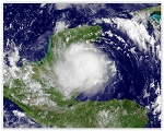
The launch of the GOES-R geostationary satellite in October 2016 could herald a new era for predicting hurricanes, according to Penn State researchers. The wealth of information from this new satellite, at time and space scales not previously possible, combined with advanced statistical hurricane prediction models, could enable more accurate predictions in the future.
"For decades, geostationary satellites such as the GOES series have been the primary tool to monitor severe weather like storms and hurricanes in real time," said Fuqing Zhang, professor of meteorology and director of Penn State's Center for Advanced Data Assimilation and Predictability Techniques. "They have helped people see what's going on in the present, but, until now, we as a community have not been able to tap into these resources to guide us to predict future severe weather."
Geostationary satellites like the GOES series orbit the Earth at a fixed location, taking snapshots of cloud formations and other meteorological information. The National Oceanic and Atmospheric Administration operates GOES with contributions from NASA.
Historically, two main challenges exist when using satellite data for hurricane predictions -- the type and amount of data collected. Satellites do not directly measure many quantities related to a hurricane's intensity, such as surface pressure, wind speeds, temperature and water vapor beneath the cloudy regions of the hurricane eyewall. They do, however, collect data known as brightness temperature, which show how much radiation is emitted by objects on Earth and in the atmosphere at different infrared frequencies. Because all objects naturally emit and absorb different amounts of radiation at different frequencies, the complexity of data poses challenges to researchers hoping to use these data for hurricane prediction models.
"At some frequencies water vapor absorbs moderate amounts of radiation passing through it, at other frequencies it absorbs most of that radiation and at other frequencies it absorbs hardly any at all. Unlike water vapor, clouds strongly absorb radiation at all of these frequencies," said Eugene Clothiaux, professor of meteorology. "Comparing measurements at different frequencies leads to information about water vapor and clouds at different altitudes above the Earth. This begins to tell us about the physical structure of water vapor fields and clouds, including those in the area around a hurricane."
Using brightness temperature satellite data to improve model forecasts of hurricanes is not straightforward. Brightness temperature information is a complex mixture related to the ground, atmospheric water vapor and clouds. The team had to develop a sophisticated analysis and modeling scheme to extract information in useful ways for model forecasts.
Page 1 of 2